.
Preferred Route through the Swales
Significant work was undertaken through 2021 to better understand how the Freeway’s impact to the Northeast and Small Swales could be minimized.
Based on what we learned, it became apparent any crossing of the Swales had to allow for movement of water, wildlife, pedestrians, and cyclists, while also preserving as much wildlife habitat as possible.
Pedestrians and Cyclists
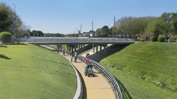
Walking, running and cycling paths will cross the freeway at multiple locations, including at the South Saskatchewan River. Paths would align with Meewasin Valley Authority's long-term trail network plans and Master Plan for the Swales.
Wildlife Crossings
Two types of wildlife underpasses were considered; an open slope span bridge and vertical wall short span bridge
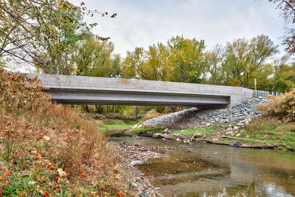
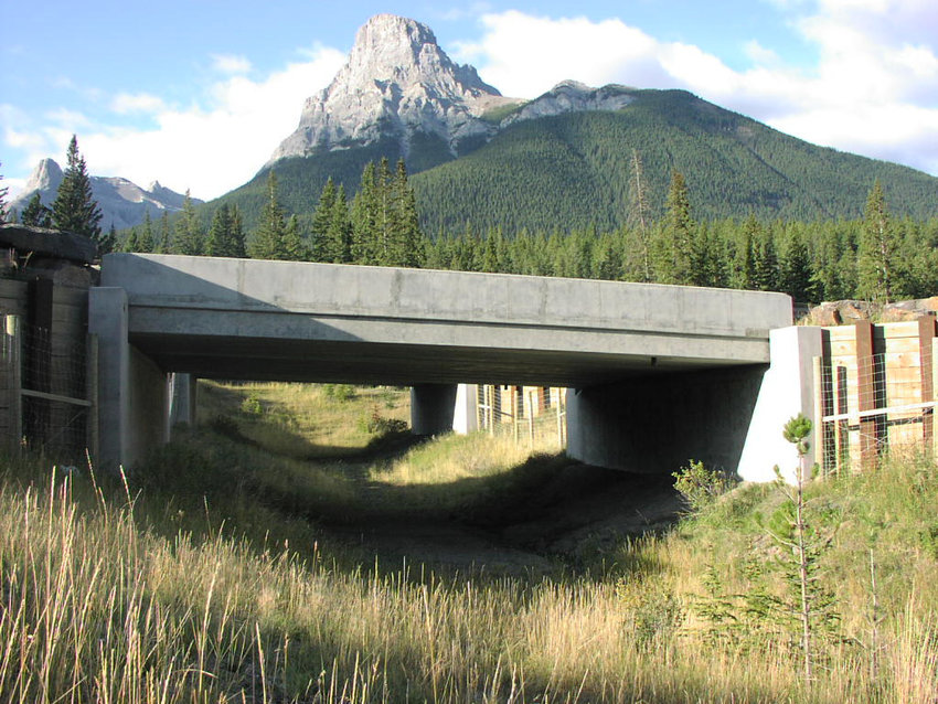
Based on the topography of the area, wildlife underpasses have been selected to ensure the safe movement of wildlife species through the northeast and Small Swale areas.
Underpasses will be built so natural light is present in the crossing; this will require space between the freeway's eastbound and westbound lanes so that crossings remain well lit and are attractive to wildlife species.
The resulting proposed design includes an open slope short span bridge.
Fencing
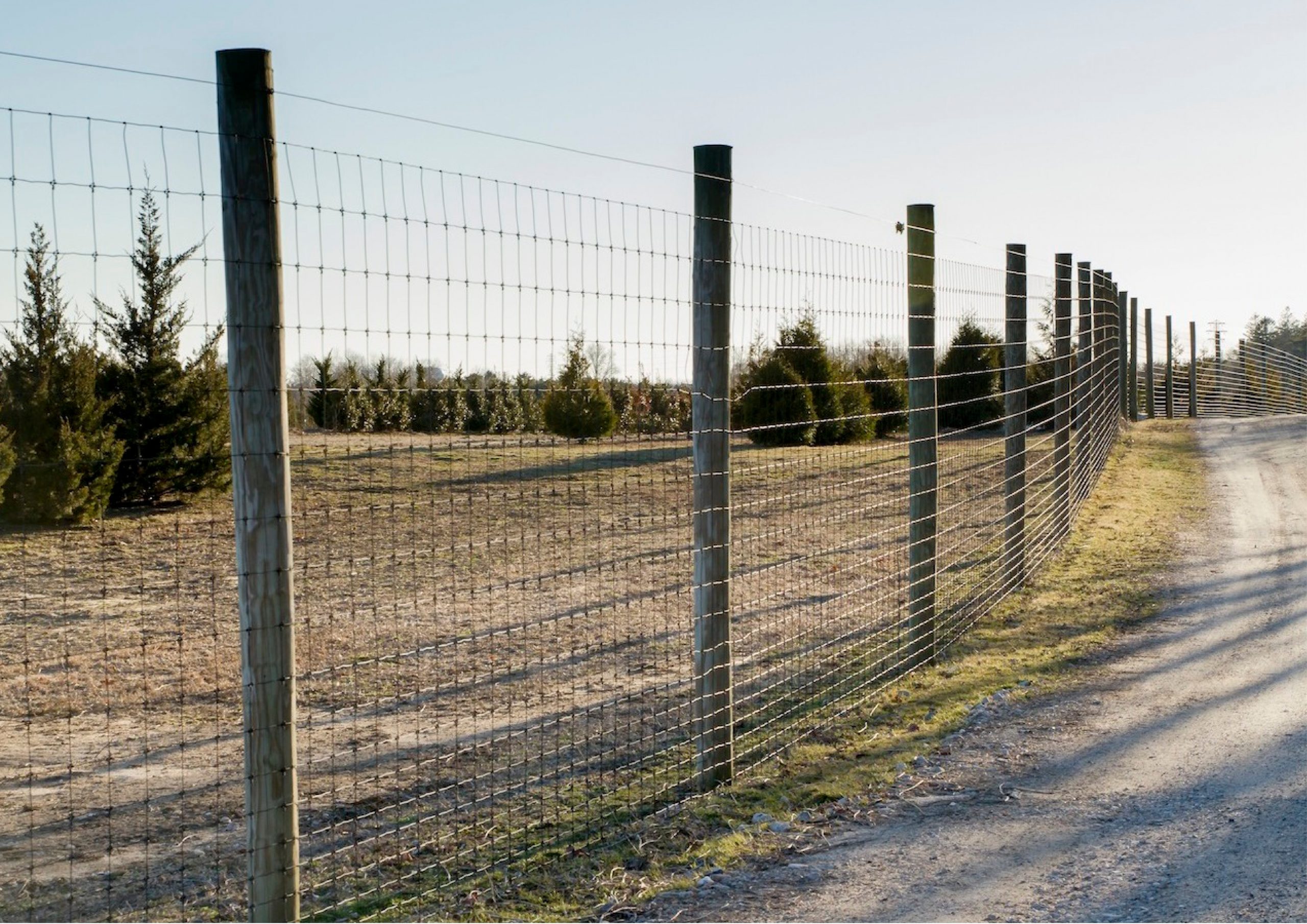
Fencing will be used to direct wildlife to these safe crossing locations.
Drainage Design
The design team modelled existing drainage patterns as a component of the functional planning study. Drainage patterns were taken into account in the preliminary designs of the preferred concept.
- The drainage design ensures that flows through environmentally sensitive areas are preserved and don’t result in changes to the overall function of these areas (i.e. the flow into these areas is not cut off)
- Drainage designs also minimize the risk of flood of the roadway and reduce flooding of adjacent lands during extreme weather events (e.g. high precipitation)
- The drainage design passes existing flow without diverting it from it’s natural path.
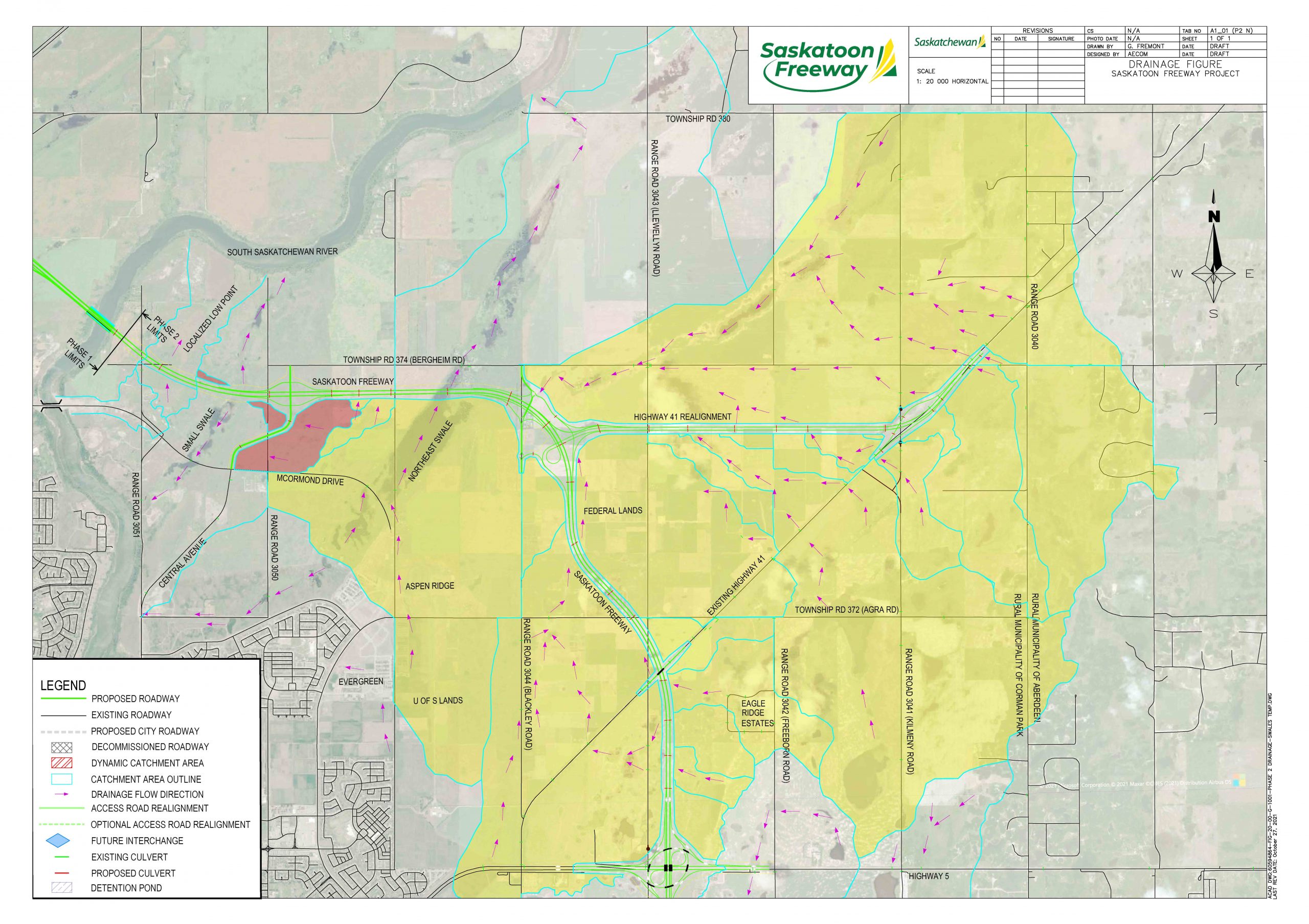
Two types of drainage structures were considered to maintain water movement across the freeway: a causeway and multiple large diameter culverts.
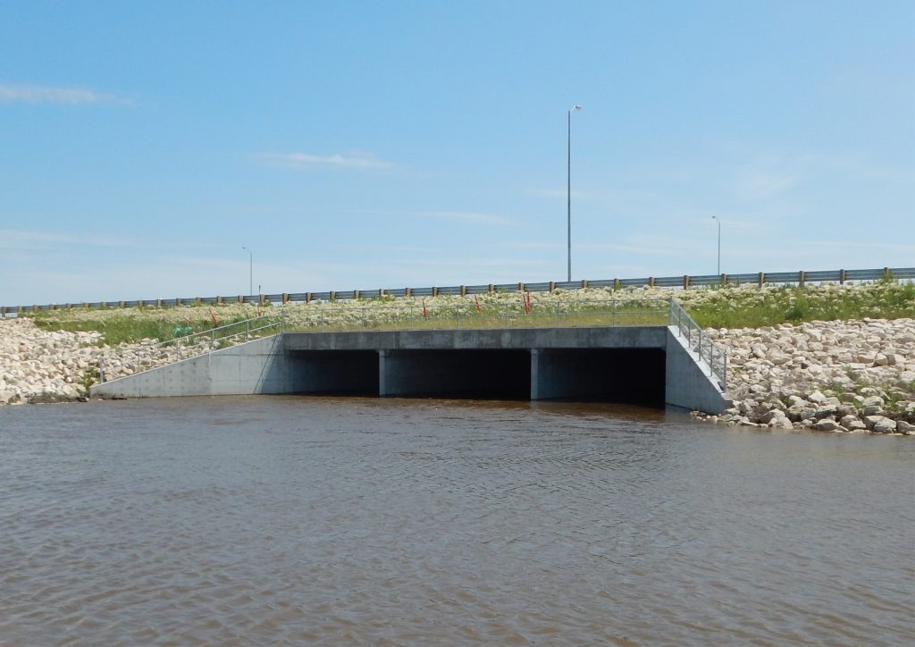
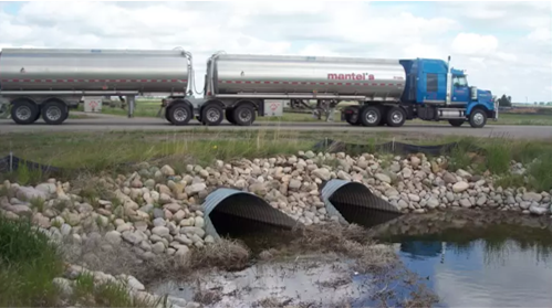
The resulting proposed design includes multiple large diameter pipes for the Northeast and Small Swale crossings.
.
Preferred Route
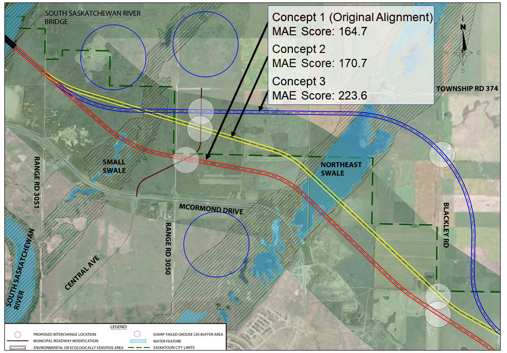
The preferred route was selected based on feedback received during a workshop which included environmental and technical experts and stakeholders. The workshop focused on evaluating Northeast and Small Swales concepts for the Saskatoon Freeway that resulted in the least environmental impact.
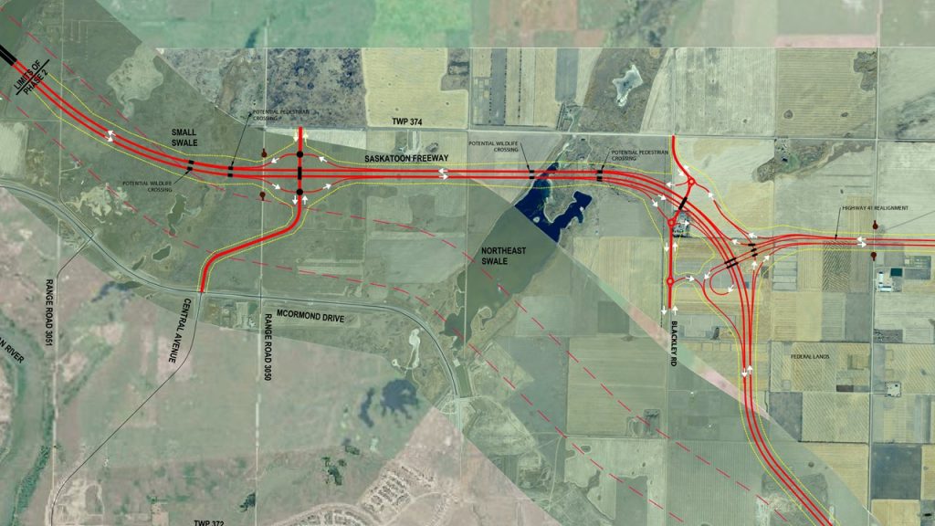
A Multiple Account Evaluation (MAE) used for evaluation of three separate alignments. The blue route received the greatest score from the MAE and was chosen as the preferred route, as shown in the map on the right.
.
This alignment has many advantages
- Minimizes open water crossing.
- Crosses the Small Swale in a previously disturbed area.
- Reduces disturbance in the Northeast Swale.
- Results in a narrower crossing of the Small Swale.
- Provides ample buffer from the Aspen Ridge neighbourhood.
- Leaves a larger habitat area between McOrmond Drive and the freeway, which is better for wildlife.
- Crosses primarily cultivated lands.
- Avoids a site where common nighthawks were seen.
Two underpass-style crossings will allow wildlife to move safely around the freeway. Multiple culverts will provide safe crossing areas for small mammals. Fencing will direct wildlife to these locations.
Walking, running and cycling paths will cross the freeway at multiple locations, including at the South Saskatchewan River. Paths would align with Meewasin Valley Authority's long-term plans.
Because this area has not been extensively studied, we completed additional work in 2021 to identify potential habitat that may need to be protected.
